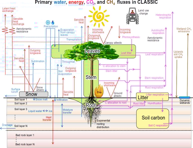
Land surface models are components of climate, weather, and hydrological models that handle exchanges of water, energy, and sometimes carbon between the land surface and the atmosphere. These models take meteorological conditions as input (wind, air humidity, precipitation, incoming radiation) and describe the response of the surface, which varies according to land cover (presence or absence of vegetation, surface roughness, etc.) and its state (soil moisture, presence of snow, etc.). Land surface models are key elements for reliable climate and hydrological forecasts and projections, and it is crucial to ensure that they realistically represent processes as they occur in cold regions.
Motivation
Surface models
Our work
Land surface models are components of climate, weather, and hydrological models that handle exchanges of water, energy, and sometimes carbon between the land surface and the atmosphere. These models take meteorological conditions as input (wind, air humidity, precipitation, incoming radiation) and describe the response of the surface, which varies according to land cover (presence or absence of vegetation, surface roughness, etc.) and its state (soil moisture, presence of snow, etc.). Land surface models are key elements for producing reliable climate and hydrological forecasts and projections, and it is crucial to ensure that they realistically represent processes as they occur in cold regions.
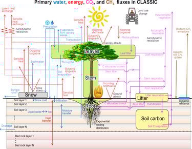
Melton et al. 2020. (https://doi.org/10.5194/gmd-13-2825-2020)
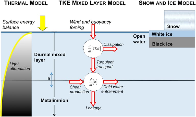
Garnaud et al. 2022. (https://doi.org/10.1029/2021MS002861)
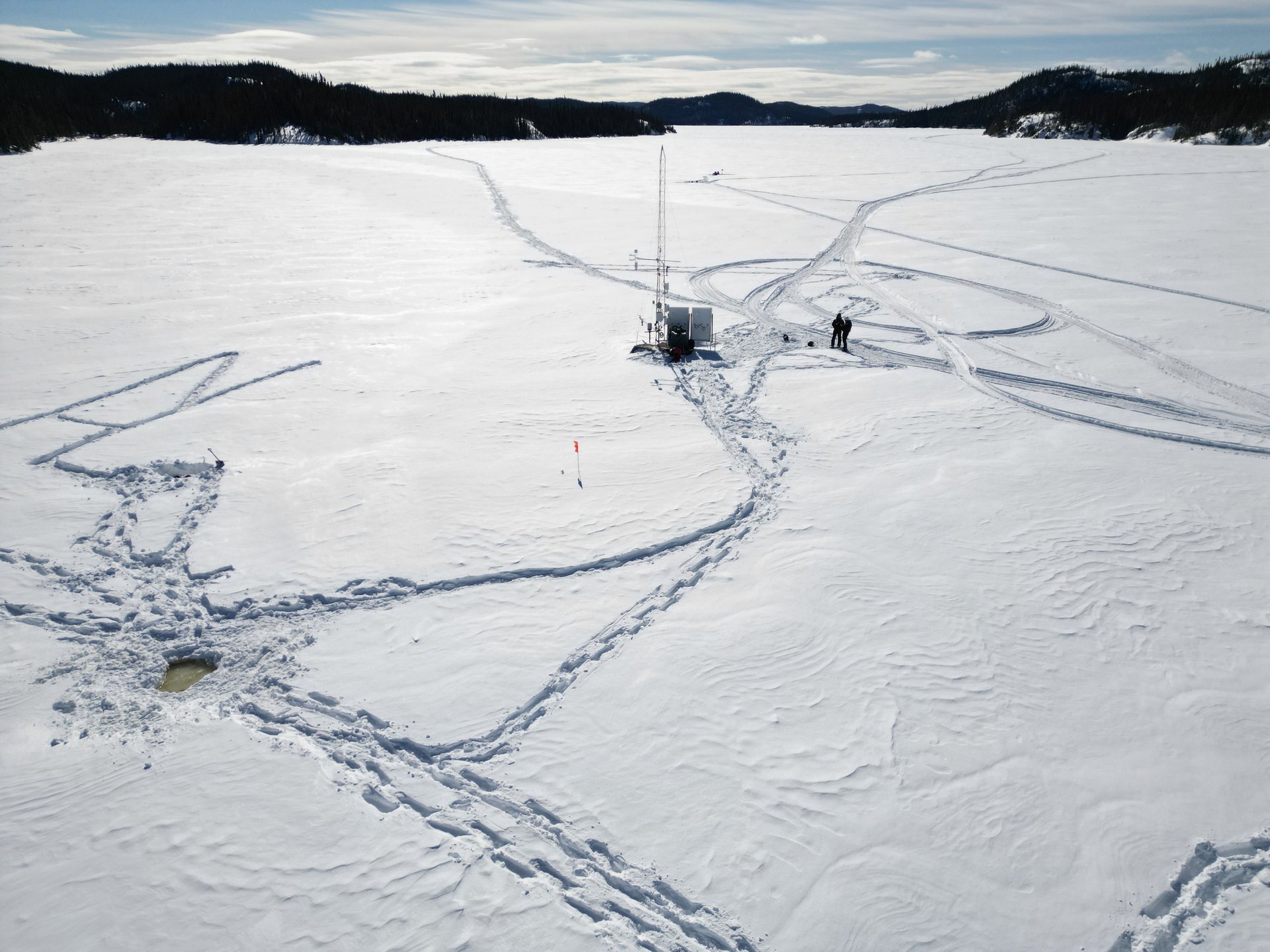
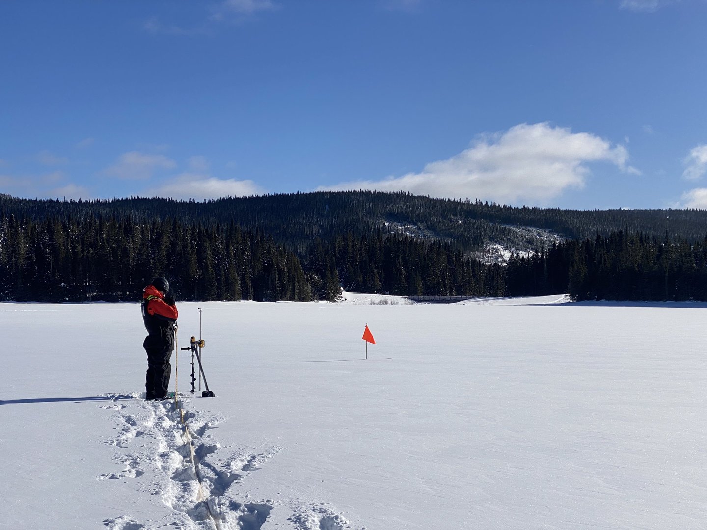
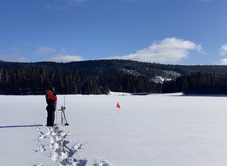
Ice thickness survey on Lake Piché
(photo credit: Emmanuelle Barrette)
Contact
© 2026. All rights reserved.
Pavillon Adrien-Pouliot
1065, avenue de la Médecine
Québec (Québec) G1V 0A6